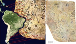
The Piri Reis Map | The 500-Year Old Chart That Shouldn’t Exist
The Piri Reis Map accurately depicts the landmass beneath the Antarctic ice sheet. How did the cartographers who originally drew up the map know this, centuries before the Antarctic was even discovered?
Copy and paste this URL into your WordPress site to embed
Copy and paste this code into your site to embed
